Top forestry and field ops teams use Marvin to forecast yields, model climate risk, and accelerate licensibility — all through a no-code platform combining satellite imagery, operational data, and simulations built for long-term land performance.
Includes site-specific analysis of water risk, growth patterns, land compliance potential, and yield performance — available free through April 30th.
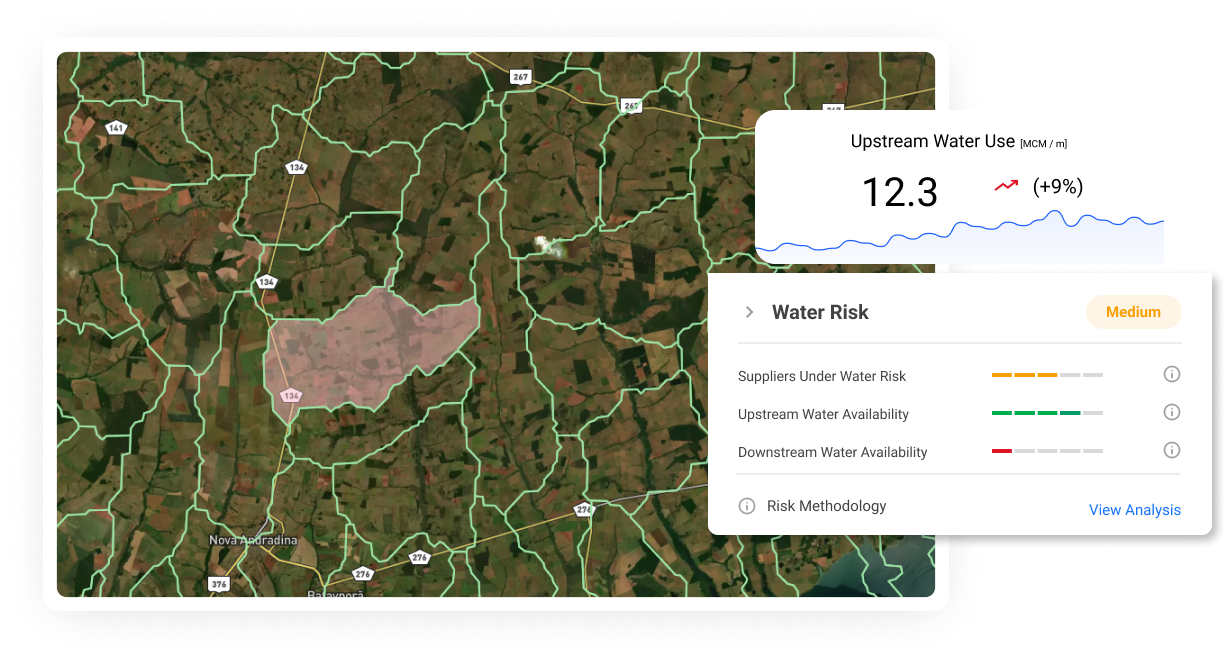
Marvin brings together water availability, yield modeling, licensibility scoring, and climate risk forecasting into a single, easy-to-use platform. Trusted by forest planners and R&D teams across LATAM, Marvin helps you scale land studies, shorten validation cycles, and make smarter expansion decisions — without ever slowing down your operation.